Course descriptions
Maps
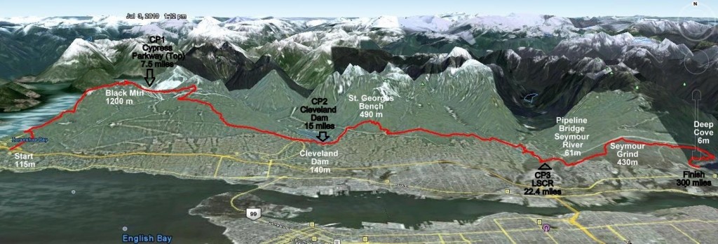
Overall course map
The overall course map is unavailable at this time.
Course map through Cypress Provincial Park
See the BC Parks PDF map here. The race starts at the parking lot off Westport Road, going north along Nelson Creek then northwest along Whyte Creek. The route then joins the Baden Powell trail and follows it northeast through the park – follow the yellow dashed line – before ending up at Craigmohr Drive where it continues east (off the map).
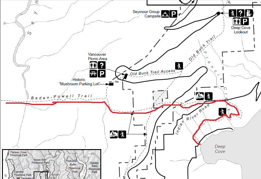
Course map through Mt. Seymour Provincial Park
The red line denotes the race route as it goes through Mt. Seymour Provincial Park. (Map credit: BC Parks)
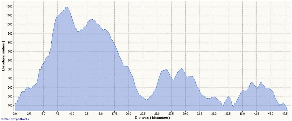
Course elevation profile


